MEGHALAYA


About MEGHALAYA

Meghalaya (/ˌmeɪɡəˈleɪə/,[6] or /meɪˈɡɑːləjə/,[7] meaning "abode of clouds"; from Sanskrit megha, "cloud" + ā-laya, "abode") is a state in northeastern India. Meghalaya was formed by carving out two districts from the state of Assam: the United Khasi Hills and Jaintia Hills, and the Garo Hills on 21 January 1972.[8] Meghalaya was previously part of Assam, but on 21 January 1972, the districts of Khasi, Garo and Jaintia hills became the new state of Meghalaya. The population of Meghalaya as of 2016 is estimated to be 3,211,474.[9] Meghalaya covers an area of approximately 22,430 square kilometres, with a length-to-breadth ratio of about 3:1.[10] The state is bound to the south by the Bangladeshi divisions of Mymensingh and Sylhet, to the west by the Bangladeshi division of Rangpur, and to the north and east by India's State of Assam. The capital of Meghalaya is Shillong. During the British rule of India, the British imperial authorities nicknamed it the "Scotland of the East".[11] English is the official language of Meghalaya. Unlike many Indian states, Meghalaya has historically followed a matrilineal system where the lineage and inheritance are traced through women; the youngest daughter inherits all wealth and she also takes care of her parents.[11] The state is the wettest region of India, with the wettest areas in the southern Khasi Hills recording an average of 12,000 mm (470 in) of rain a year.[10] About 70 percent of the state is forested.[12] The Meghalaya subtropical forests ecoregion encompasses the state; its mountain forests are distinct from the lowland tropical forests to the north and south. The forests are notable for their biodiversity of mammals, birds, and plants. Meghalaya has predominantly an agrarian economy with a significant commercial forestry industry. The important crops are potatoes, rice, maize, pineapples, bananas, papayas, and spices. The service sector is made up of real estate and insurance companies. Meghalaya's gross state domestic product for 2012 was estimated at ₹16,173 crore (US$2.3 billion) in current prices.[13] The state is geologically rich in minerals, but it has no significant industries.[11] The state has about 1,170 km (730 mi) of national highways. It is also a major logistical center for trade with Bangladesh.


Geography Of Meghalaya

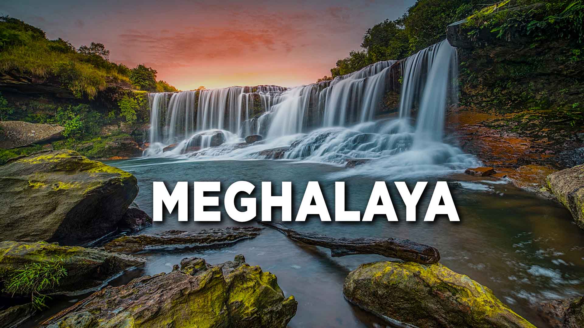
Meghalaya is one of the Seven Sister States of northeast India. The state of Meghalaya is mountainous, with stretches of valley and highland plateaus, and it is geologically rich. It consists mainly of Archean rock formations. These rock formations contain rich deposits of valuable minerals like coal, limestone, uranium and sillimanite. Meghalaya has many rivers. Most of these are rainfed and seasonal. The important rivers in the Garo Hills region are Ganol, Daring, Sanda, Bandra, Bugai, Dareng, Simsang, Nitai and the Bhupai. In the central and eastern sections of the plateau, the important rivers are Khri, Umtrew, Digaru, Umiam or Barapani, Kynshi (Jadukata), Umngi, Mawpa, Umiam Khwan, Umngot, Umkhen, Myntdu and Myntang. In the southern Khasi Hills region, these rivers have created deep gorges and several waterfalls. The elevation of the plateau ranges between 150 m (490 ft) to 1,961 m (6,434 ft). The central part of the plateau comprising the Khasi Hills has the highest elevations, followed by the eastern section comprising the Jaintia Hills region. The highest point in Meghalaya is Shillong Peak, which is a prominent IAF station in the Khasi Hills overlooking the city of Shillong. It has an altitude of 1961 m. The Garo Hills region in the western section of the plateau is nearly plain. The highest point in the Garo Hills is Nokrek Peak with an altitude of 1515 m. With average annual rainfall as high as 12,000 mm (470 in) in some areas, Meghalaya is the wettest place on earth.[29] The western part of the plateau, comprising the Garo Hills region with lower elevations, experiences high temperatures for most of the year. The Shillong area, with the highest elevations, experiences generally low temperatures. The maximum temperature in this region rarely goes beyond 28 °C (82 °F),[30] whereas sub-zero winter temperatures are common.



Transport in Meghalaya

The partition of the country in 1947 created severe infrastructural constraints for the Northeastern region, with merely 2% of the perimeter of the region adjoining the rest of the country. A narrow strip of land often called the Siliguri Corridor or the Chicken's Neck, connects the region with the state of West Bengal. Meghalaya is a landlocked state with many small settlements in remote areas. The road is the only means of transport. While the capital Shillong is relatively well connected, road connectivity in most other parts is relatively poor. A significant portion of the roads in the state is still unpaved. Most of the arrivals into the Meghalaya take place through Guwahati in neighbouring Assam, which is nearly 103 km away. Assam has a major railhead as well as an airport with regular train and air services to the rest of the country. When Meghalaya was carved out of Assam as an autonomous state in 1972, it inherited a total road length of 2786.68 km including 174 km of National Highways with road density of 12.42 km per 100 square kilometre. By 2004, total road length has reached up to 9,350 km out of which 5,857 km were surfaced. The road density had increased to 41.69 km per 100 square kilometre by March 2011. However, Meghalaya is still far below the national average of 75 km per 100 km2. To provide better services to the people of the state, the Meghalaya Public Works Department is taking steps for improvement and up-gradation of the existing roads and bridges in phased manner. Meghalaya has a road network of around 7,633 km, out of which 3,691 km is black-topped and the remaining 3942 km is gravelled. Meghalaya is also connected to Silchar in Assam, Aizawl in Mizoram, and Agartala in Tripura through national highways. Many private buses and taxi operators carry passengers from Guwahati to Shillong. The journey takes from 3 to 4 hours. Day and night bus services are available from Shillong to all major towns of Meghalaya and also other capitals and important towns of Assam and the northeastern states. Meghalaya has a railhead at Mendipathar and regular train service connecting Mendipathar in Meghalaya and Guwahati in Assam, has started on 30 November 2014.[85] The Cherra Companyganj State Railways was a former mountain railway through the state.[86] Guwahati (103 kilometres (64 mi) from Shillong) is the nearest major railway station connecting the north-east region with the rest of the country through a broad gauge track network. There is a plan for extending the rail link from Guwahati to Byrnihat (20 kilometres (12 mi) from Guwahati) within Meghalaya and further extending it up to state capital Shillong.


Tourism in Meghalaya

Earlier, foreign tourists required special permits to enter the areas that now constitute the state of Meghalaya. However, the restrictions were removed in 1955. Meghalaya is compared to Scotland for its highlands, fog, and scenery.[11] Meghalaya has some of the thickest primary forests in the country and therefore constitutes one of the most important ecotourism circuits in India. The Meghalaya subtropical forests support a vast variety of flora and fauna. Meghalaya has 2 National Parks and 3 Wildlife Sanctuaries. Meghalaya also offers many adventure tourism opportunities in the form of mountaineering, rock climbing, trekking, and hiking, caving (spelunking) and water sports. The state offers several trekking routes, some of which also afford an opportunity to encounter rare animals. The Umiam Lake has a water sports complex with facilities such as rowboats, paddleboats, sailing boats, cruise-boats, water-scooters, and speedboats. Cherrapunji is a tourist destination in north-east of India. It lies to the south of the capital Shillong. A rather scenic 50-kilometre long road connects Cherrapunji with Shillong. Living root bridges are also a tourist draw, with many examples located near Cherrapunji.[90] The Double-Decker root bridge, along with several others, is found in the village of Nongriat, which is tourist friendly. Many other root bridges can be found nearby, in the villages of Nongthymmai, Mynteng, and Tynrong.[81] Other areas with root bridges include Riwai village, near the tourist village of Mawlynnong, Pynursla, especially the villages of Rangthyllaing and Mawkyrnot, and the area around Dawki, in the West Jaintia Hills district, where there are many living root bridges scattered throughout the nearby villages.[