[11:48 PM, 9/26/2021] Riya Bansal KIET: MAHARASHTRA

MAHARASHTRA


About MAHARASHTRA

Maharashtra is the second-most populous state in India as well as the third-most populous country subdivision in the world. It was formed on 1 May 1960 by splitting the bilingual Bombay State, which had existed since 1956, into majority Marathi-speaking Maharashtra and Gujarati-speaking Gujarat. Thus Maharashtra is a Marathi linguistic state. The state is divided into 6 divisions and 36 districts, with the state capital being Mumbai, also the most populous urban area in India and Nagpur serving as the winter capital. The Godavari and the Krishna are the two major rivers in the state. Marathi is the most widely spoken language and is also the official language of the state. The forest cover in the state is 16.47% of the state's geographical area. Out of the total cultivable land in Maharashtra, about 60% is used for grain crops with Jowar (Sorghum bicolor) being the dominating crop. Spread over 307,713 km2 (118,809 sq mi), it is the third-largest state by area in India. Maharashtra is bordered by the Arabian Sea to the west, the Indian states of Karnataka and Goa to the south, Telangana to the southeast and Chhattisgarh to the east, Gujarat and Madhya Pradesh to the north, and the Indian union territory of Dadra and Nagar Haveli and Daman and Diu to the northwest. I


Geography Of RAMAHARASHTRA

Maharashtra occupies the western and central part of the country and has a long coastline stretching 720 kilometres[57] along the Arabian Sea.[58] One of the more prominent physical features of Maharashtra is the Deccan plateau, which is separated from the Konkan coastline by 'Ghats'.[59] The Ghats are a succession of steep hills, periodically bisected by narrow roads. Most of the famous hill stations of the state are at the Ghats. The Western Ghats (or the Sahyadri Mountain range) provide a physical backbone to the state on the west, while the Satpura Hills along the north and Bhamragad-Chiroli-Gaikhuri ranges on the east serve as its natural borders.[60] The state is surrounded by Gujarat to the north west, Madhya Pradesh to the north, Chhattisgarh to the east, Telangana to the south east, Karnataka to the south and Goa to the south west.


Transport in MAHARASHTRA

The state has a large, multi-modal transportation system with the largest road network in India.[173] In 2011, the total length of surface road in Maharashtra was 267,452 km;[174] national highways comprised 4,176 km[175] and state highways 3,700 km.[174] The Maharashtra State Road Transport Corporation (MSRTC) provides economical and reliable passenger road transport service in the public sector.[176] These buses, popularly called ST (State Transport), are the preferred mode of transport for much of the populace. Hired forms of transport include metered taxis and auto rickshaws, which often ply specific routes in cities. Other district roads and village roads provide villages accessibility to meet their social needs as well as the means to transport agricultural produce from villages to nearby markets. Major district roads provide a secondary function of linking between main roads and rural roads. Almost 98% of villages are connected via the highways and modern roads in Maharashtra. Average speed on state highways varies between 50 and 60 km/h (31–37 mi/h) due to heavy presence of vehicles; in villages and towns, speeds are as low as 25–30 km/h (15–18 mi/h)


Tourisim in MAHARASHTRA

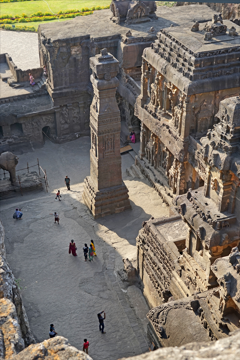
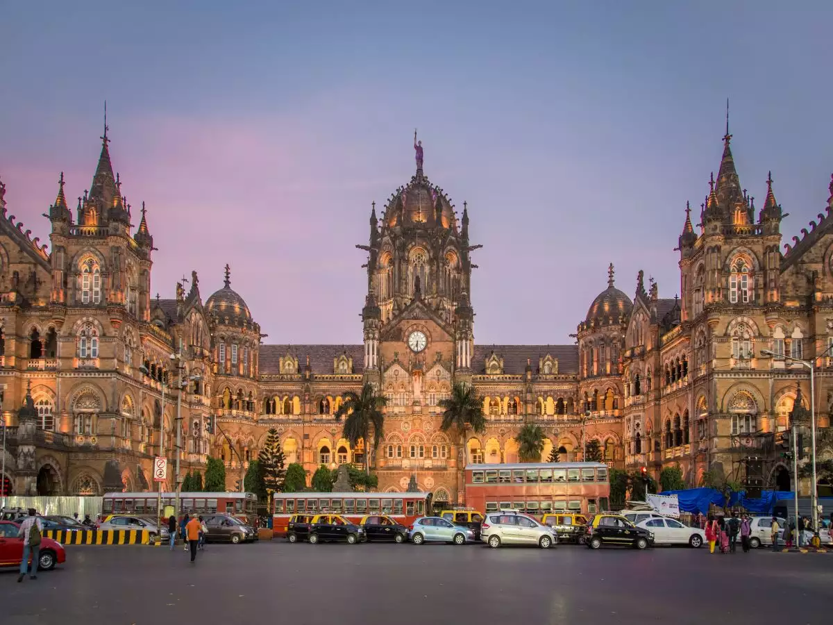
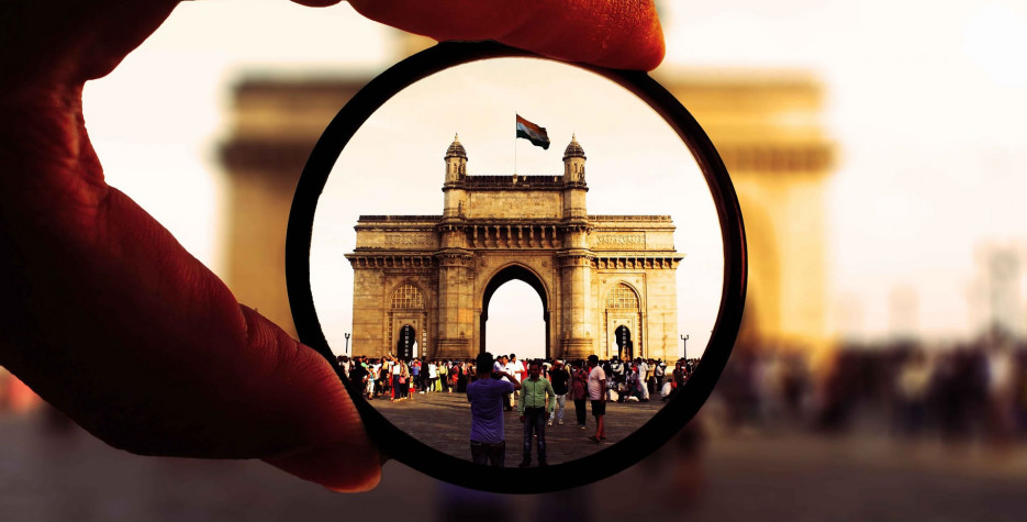
Mumbai, the biggest and the most cosmopolitan city in India attracts tourists from all over the world for its many attractions including colonial architecture, beaches, movie industry, shopping, and an active nightlife. Pune, called the cultural capital of Maharashtra, also attracts many visitors during the annual Ganeshotsav festival. According to a survey, most tourists visiting places in Maharashtra are from the state. Two other states, Gujarat and Andhra Pradesh send the largest number of domestic visitors to Maharashtra. Foreign visitors to Maharashtra account for just 2% of the tourists. Visitors from the US, UK, Germany, and UAE each form a significant percentage of foreign tourists.[286] The area around Aurangabad has many ancient and medieval sites including the UNESCO World Heritage Sites of Ajanta and Ellora caves, the Daulatabad Fort, and the Bibi Ka Maqbara in Aurangabad.

[11:48 PM, 9/26/2021] Riya Bansal KIET: MAHARASHTRA [11:48 PM, 9/26/2021] Riya Bansal KIET: PUNJAB

PUNJAB


About PUNJAB

Forming part of the larger Punjab region of the Indian subcontinent, the state is bordered by the Indian states of Himachal Pradesh to the north and northeast, Haryana to the south and southeast, and Rajasthan to the southwest, by the Indian union territory of Chandigarh to the east, and by the region of Jammu and Kashmir administered by India as a union territory, to the north. It is bordered by Punjab, a province of Pakistan to the west.[8] The state covers an area of 50,362 square kilometres (19,445 square miles), 1.53% of India's total geographical area.[9] It is the 20th-largest Indian state by area. With over 27 million inhabitants, Punjab is the 16th-largest state by population, comprising 23 districts.[2] Punjabi, written in the Gurmukhi script, is the most widely spoken and official language of the state.[10] The main ethnic group are the Punjabis, with Sikhs and Hindus as the dominant religious groups.[11] The state capital is Chandigarh, a Union Territory and also the capital of the neighbouring state of Haryana. The five tributary rivers of the Indus River from which the region took its name are the Sutlej, Ravi, Beas, Chenab and Jhelum rivers; the Sutlej, Ravi and Beas rivers flow through the Indian Punjab.


Geography Of PUNJAB

Punjab is in northwestern India and has a total area of 50,362 square kilometres (19,445 sq mi). Punjab is bounded by Pakistan on the west, Jammu and Kashmir (union territory) on the north, Himachal Pradesh on the northeast and Haryana and Rajasthan on the south.[8] Most of the Punjab lies in a fertile, alluvial plain with many rivers and an extensive irrigation canal system.[62] A belt of undulating hills extends along the northeastern part of the state at the foot of the Himalayas. Its average elevation is 300 metres (980 ft) above sea level, with a range from 180 metres (590 ft) in the southwest to more than 500 metres (1,600 ft) around the northeast border. The southwest of the state is semiarid, eventually merging into the Thar Desert. The Shiwalik Hills extend along the northeastern part of the state at the foot of the Himalayas.[citation needed] The soil characteristics are influenced to a limited extent by the topography, vegetation and parent rock.


Transport in PUNJAB

Air Sri Guru Ram Dass Jee International Airport in Amritsar Sri Guru Ram Dass Jee International Airport in Amritsar, is the Primary Hub Airport and Gateway to Punjab, as the airport serves direct connectivity to key cities around the world, including London, Singapore, Moscow, Dubai, Birmingham among others. Punjab has six civil airports including two international airports: Amritsar International Airport and Chandigarh International Airport; and four domestic airports: Bathinda Airport, Pathankot Airport, Adampur Airport (Jalandhar) and Sahnewal Airport (Ludhiana). Apart from these 6 airports, there are 2 airfields at Beas (Amritsar) and Patiala which do not serve any commercial flight operations, as of now. Railways View of Ludhiana Railway Station The Indian Railways' Northern Railway line runs through the state connecting most of the major towns and cities. The Shatabdi Express, India's fastest series of train connects Amritsar to New Delhi covering total distance of 449 km. Amritsar Junction Railway Station is the busiest junction of the state. Bathinda Junction holds the record of maximum railway lines from a railway junction in Asia. Punjab's major railway stations are Amritsar Junction (ASR), Ludhiana Junction (LDH), Jalandhar Cantonment (JRC), Firozpur Cantonment (FZR), Jalandhar City Junction (JUC), Pathankot Junction (PTK) and Patiala railway station (PTA). The railway stations of Amritsar is included in the Indian Railways list of 50 world-class railway stations


Tourisim in PUNJAB

Tourism in Indian Punjab centres around the historic palaces, battle sites, and the great Sikh architecture of the state and the surrounding region.[177] Examples include various sites of the Indus Valley Civilization, the ancient fort of Bathinda, the architectural monuments of Kapurthala, Patiala, and Chandigarh, the modern capital designed by Le Corbusier.[178] The Golden Temple in Amritsar is one of the major tourist destinations of Punjab and indeed India, attracting more visitors than the Taj Mahal. Lonely Planet Bluelist 2008 has voted the Harmandir Sahib as one of the world's best spiritual sites.[179] Moreover, there is a rapidly expanding array of international hotels in the holy city at Heritage Walk Amritsar that can be booked for overnight stays.